Maps are integral to our heritage. Their ancient paths and roads create such nostalgia in our minds that's it's hardly surprising they have become such a recurring theme in interior design. With antique map fairs surging in popularity and the high street awash with map-print accessories, this fascinating world of politics, curiosities and monsters is as collectable as ever.
And it's not difficult to introduce this wealth of ancient knowledge into your own home either! With these seven easy decorating tips, you'll easily find yourself amid a collage of travel, history and adventure...
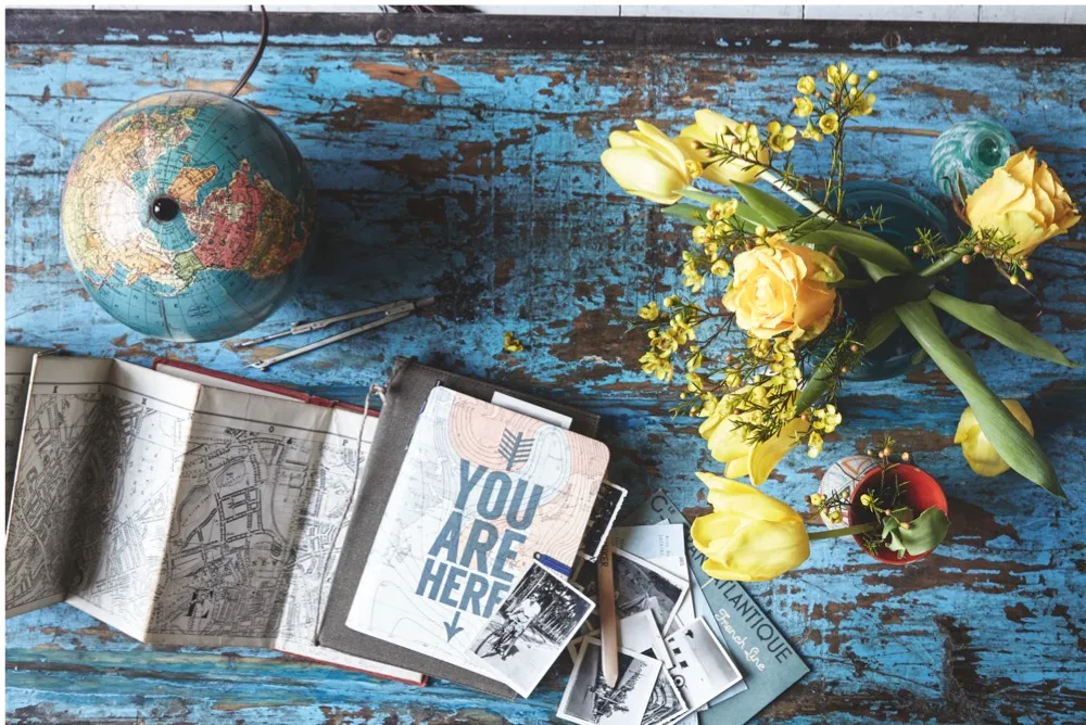
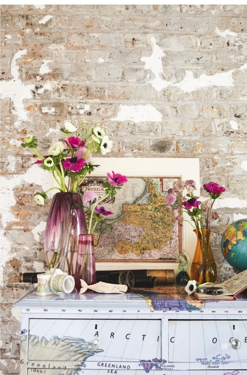
Create a tabletop display on an antique coffee table
The start contrast between fresh, floral blooms and worn antique maps adds a nostalgic touch to this coffee table display.
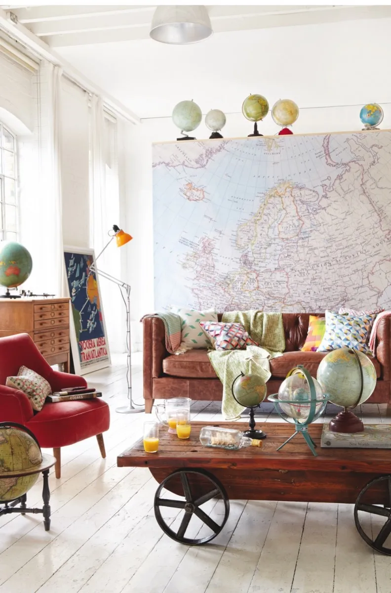
Curate vignettes with old maps and globes
Play with scale on a dividing wall and add height with a family of globes along a high shelf for impact. Or cluster smaller and less rare pieces on a coffee table for a display that you can pick up and hold.
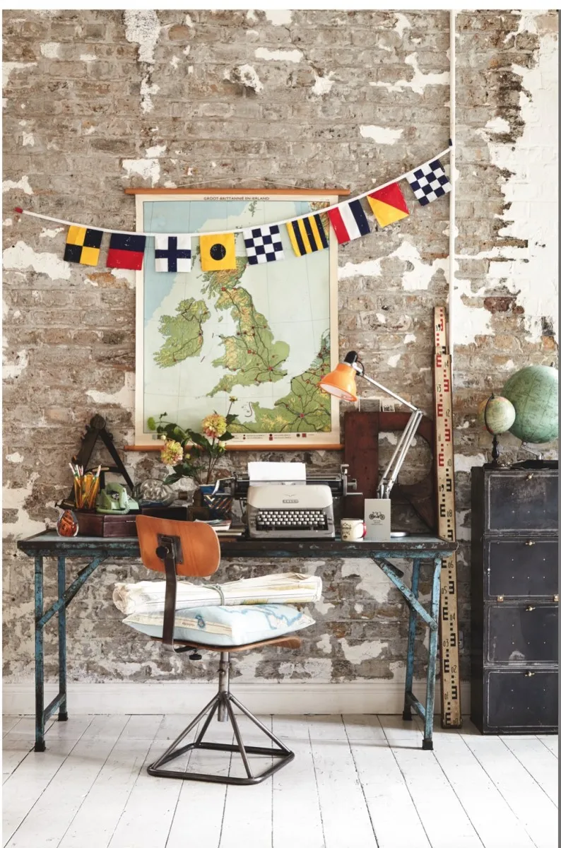
Create a distressed look with vintage wall charts and industrial furniture
Distressed vintage furniture and an old ship's locker sit wonderfully with a mid-century map made in Holland, for a travel writer's retreat at home.
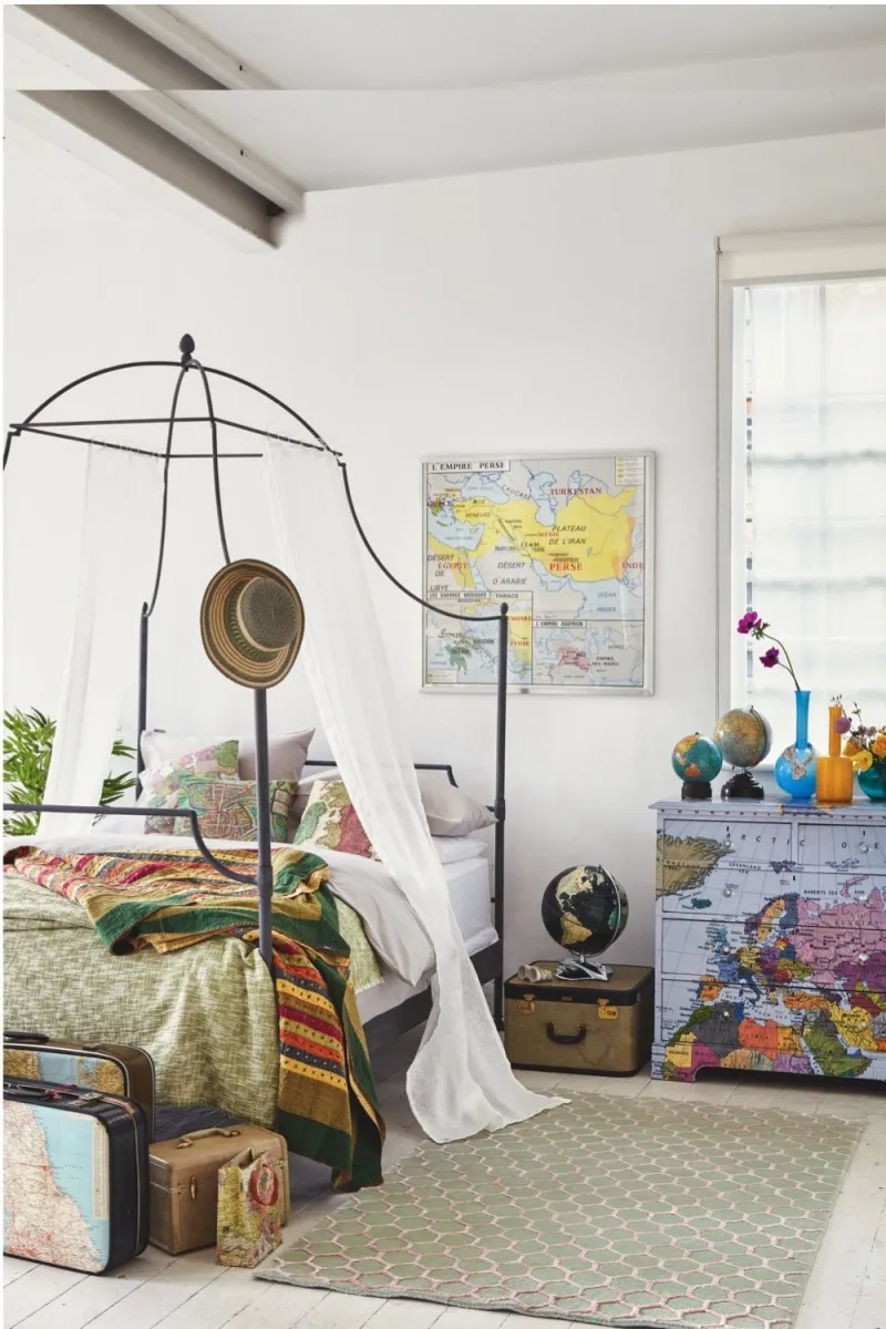
Preserve an old map with antique frames, or try decoupaging a chest of drawers
Take inspiration from your globetrotting adventures by framing an old school chart to keep it preserved. Add a map decoupaged chest of drawers, drape the bed with sheer linen and add extra storage with a set of upcycled vintage suitcases.
Use antique maps to create a colour co-ordinated display
A map such as this Flemish cartographic design is a wonderful starting point for a room colour scheme featuring leafy greens, anemone pinks and summery sunflower yellows.
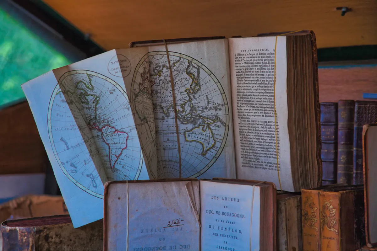
What's the history of maps?
To hold a 16th-century map in your hands is to be drawn into an era of discoveries and danger, of exploration and exploitation, and of unparalleled excitement in the advances of mankind. Here, art, science, geography and culture combine in a spectacular and unique way. ‘Antique maps vividly and graphically chart European man’s growing knowledge of the world,’ says Philip Curtis of The Map House. ‘They are one of the most direct ways of seeing their creators’ world view.’
The golden era of cartography began in the mid 15th century with the rediscovery of Ptolemy’s Ancient Greek Geographia. This coincided with the invention of movable type printing, which enabled maps to be reproduced more easily and circulated widely. This was the Age of Discovery, in which European sailors left for uncharted waters and, in wave upon wave of expansionism, ‘discovered’ the New World.
From the early 16th century, improved geographical instruments and methods of survey allowed large areas to be mapped more accurately than ever before and, back home, the map makers enjoyed a boom.
In 1507 Martin Waldseemüller’s immense world map was printed, the first to name ‘America’ (after accounts by the explorer Amerigo Vespucci) and the first to show North and South America clearly separated from Asia.
Gerardus Mercator, cartographer and globe-maker, published his famous world map in 1569, drawn to what was later known as the Mercator projection. And in 1579, Christopher Saxton’s atlas set a standard for maps of England and Wales that was unrivalled for almost two centuries.
How were maps and globes first created?
The distant origins of antique maps can be found in 15th-century Italy. 'The very first printed map was made in Bologna in 1477, using copper engraved plates,' reveals Philip Curtis, Director at The Map House in Knightsbridge. 'It wasn't showing contemporary knowledge - it was recovering ancient knowledge that was already known to the Greeks and Romans.'
The Ancient Greeks created the first examples of globes, albeit celestial ones. The first terrestrial globe may have been made as far back as 140BC by Cratos of Mallos. We don’t know exactly what it depicted as the Greeks were only aware of a small part of the planet. The earliest surviving terrestrial globe was made by Martin Behaim in Nuremberg in 1492: it is believed to have inspired Christopher Columbus to sail west for the Orient.
Many map makers also produced globe gores – specially printed tapering shapes that wrapped around to form a sphere. Globe production, often of pairs showing both the earth and the heavens, continued throughout the 16th century.
Initially, possessing a globe was a status symbol for the very wealthy but gradually, as hand-painted wooden globes gave way to printed, paper-covered spheres, they became more and more widely available. By the 19th century, pocket globes had become a popular accessory for the middle-class gentleman.
Who are the key map makers to look out for?
The 17th century saw a continuing development in geographical knowledge, and map makers kept pace. Many of them were based in Amsterdam, a reflection of the Dutch domination of world shipping routes. The great makers include Willem Blaeu and his son Johannes, Jan Jansson, Frederick de Wit and Jodocus Hondius, who provided maps of all kinds – from sea charts to town plans – to satisfy constantly growing demand.
Major works by such key names are rare and expensive. In May 2008, a single 1664 world map by Johannes Blaeu that shows California as an island – a map maker’s misconception for much of the 17th century – was sold at Sotheby’s for £17,300.
A year earlier, an11-volume Atlas Major dating from 1665, alsoby Johannes Blaeu, sold for £264,000.
Why do you sometimes see blank spaces on antique maps?
The science of map making was inextricably linked with the artefacts’ beauty, whether in earlier woodcut prints or, from around 1550, fabulously detailed copper engravings. ‘Map makers were aiming for a combination of artistry and accuracy,’ says renowned dealer Jonathan Potter. ‘Accuracy was relative because at the time people didn’t really know whether something was three miles or five miles away.’
Gaps in knowledge left blank areas on maps, which were unhesitatingly filled in with images of mythological creatures, heraldic devices, compass roses, flora and fauna and ‘native’ inhabitants. Elaborate cartouches giving the title, the name of the cartographer and a dedication were common.
Topographical details often included a swirled or stippled sea, shaded hills, and castles or church spires to indicate towns. These were all produced by the most highly skilled draftsmen and artists of their day and reflected the fashions of the age.
How much does it cost to buy an antique map?
It’s possible to buy an antique map for as little as £15 and you may even come across one for even less at a car boot sale or in a charity shop. Around £100-£250 will secure a good map of an English county by Robert Morden, a popular 17th-century publisher and cartographer. For a similar price, it’s possible to purchase an 1851 country map by London publisher John Tallis.
Based on his world atlas and issued to commemorate the Great Exhibition, they are considered to be the last great series of decorative maps. By this time, mapping was a technically demanding skill and modern maps were required to be increasingly utilitarian – though some would say none the less interesting. Certain collectors even specialise in 19th- or 20th-century maps, such as those of American roads or the London Underground.
Single European or British maps by the Blaeu family can cost less than £1,000, while a good world map is likely to be £1,500 or more. Globe prices are much higher, a reflection of the smaller numbers in which they were produced. ‘Although globes from the 1920s or 30s might cost £300 to £700, anything earlier than the 20th century will cost something in four figures, if not five,’ says Philip. Indeed, a pair of late 17th-century globes by renowned Venetian maker Vincenzo Coronelli sold at Christie’s in December 2007 for £58,100.
From world maps, town plans, sea charts, celestial maps or curiosities such as maps that satirically depict countries in the shape of people, the potential map collector has a wealth of distinct areas to choose from. Antiques Roadshow expert Clive Farahar explains that most people start with a map that features where they live or somewhere they have visited. ‘The lovely thing about maps is that they are very useful things with which to decorate a room and to display your own part of the world. And their values don’t seem to come down, so they do it all,’ he says.
Caroline Batchelor, of the International Map Collector’s Society (IMCoS), has been collecting antique maps for 40 years. She’s amassed hundreds of examples, mostly showing places that she and her husband have lived, from the Philippines to Africa.
‘My earliest map dates from about 1540, up to a 19th-century one of Sudan,’ she says. ‘I try to stick to Africa now but, if I see an attractive map of somewhere else, I may not be able to resist it. I have them scattered around the house but keep most of them in a plan chest. They also make wonderful presents – they have such visual appeal and although I am not terribly academic about the way I collect, researching is half the fun. Collecting has definitely enriched my life.’
How to display antique maps
Antique maps, framed and hung on the wall, can provide a striking evocation of world history, a reminder of family background or simply a memento of a happy holiday. As with paintings, smaller maps look best in groups using coordinating frames, while care must be taken that very large maps do not dominate a room. Older maps were printed in black and white, and then sometimes hand-coloured before being sold; some were coloured later.
Jenny Harvey, another keen collector, has hung some of her 100-plus maps up the stairwell of her three-storey house. ‘I have a mixture of coloured and uncoloured,’ she explains. ‘It’s not as gaudy as if they were paintings, so it works well.’ She has been collecting for 21 years, starting with an impulse purchase of a map of Somerset, where she was born.
Since then she has continued to collect maps of the county and has added town plans of London, where she lives now. ‘I am typical in that respect,’ she says. ‘I don’t collect in a technical way but in an emotional way – I want examples that appeal to me. Having said that, if you learn a little more about maps, you do get more out of looking at them. I love antique maps because of the stories they tell about history and geography and people and places.’
John Ogilby, 1600-1676
Scotsman John Ogilby, publisher of the first modern road atlas, was a man of many talents, whose life was a series of dramatic lurches from riches to poverty. He became a ‘sworn viewer’ or surveyor of the City of London after the Great Fire of 1666. This led to his most ambitious and successful venture: mapping the roads of England and Wales. In 1674, he received the title of ‘His Majesty’s Cosmographer and Geographick Printer’ and, the following year, his Britannia was published.
It was the first national road atlas of any country in western Europe, the first to use a uniform scale, of one inch to a mile, and the first to establish the now-standard length of a mile as 1,760 yards. The atlas was an immediate commercial success and much-copied by other map-makers. Sheets from Britannia are widely collected and can be bought for less than £300 each. A first edition of the entire atlas was sold at Sotheby’s last year for £11,875.
How to tell if an antique map is an original
‘In the map trade, from the earliest times, a print made from a particular woodblock or copper plate has been regarded as “original” and, until that block or plate was destroyed, “originals” could be printed from it,’ write Carl Moreland and David Bannister in Antique Maps: A Collector’s Guide. The blocks or plates could be used for a century or more, during which time details could be added or deleted. Some prints could be black and white, and others coloured.
A strong, clear impression suggests an early edition. As to how many of each map were printed, it is almost impossible to say, and just as difficult to know how many have survived. Moreland and Bannister point out that an edition generally consisted of a few hundred examples, compared to the 68 million Penny Blacks that were issued in 1840. Buyers should be aware that both valid reproductions and forgeries are widely available and, if in doubt, consult an expert.

